
Clinchfield Loops (NC): Map, History, Operation
Last revised: August 24, 2024
By: Adam Burns
The Clinchfield Loops are a series of spiral-shaped railway loops located in North Carolina, USA. They were constructed by the Clinchfield Railroad in the early 20th century to navigate the steep terrain of the Blue Ridge Mountains.
The loops, which include 18 tunnels and numerous bridges, allow trains to gain elevation while maintaining a manageable grade. They are considered an engineering marvel and are still in use today.
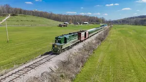
The loops are located south of Spruce Pine, North Carolina in the state's western Smoky Mountains which kept the grades of the Carolina, Clinchfield & Ohio Railway (better known as the Clinchfield) to a reasonable stature of under 2%.
The completion of the CC&O marked decades of attempts in building a railroad from the Kentucky to South Carolina. The loops, and the railroad in general, were incredibly expensive to build featuring literally miles of tunnels and bridges.
However, the right-of-way was so well laid out and constructed that it turned the Clinchfield into a very profitable coal-hauling road in the years to follow. During a two-year period, from 2015-2017, the loops and the former CC&O main line was closed as a through corridor.
That all changed with E. Hunter Harrison became CSX's president on March 7, 2017. His so-called "Precision Scheduled Railroading" concept involved fast turnaround times, reducing the need for hump yards.
As a result, several were closed and CSX's traffic patterns changed. This brought new life to the Clinchfield. Trains returned only a month after Harrison came on board and the Loops now act as a relief valve for other parts of the CSX network.
Photos
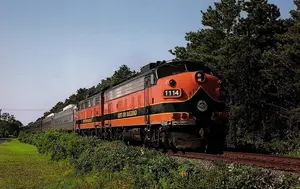
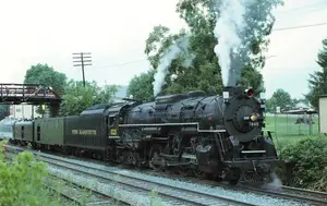
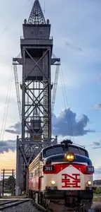
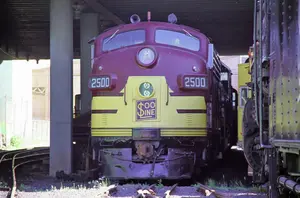
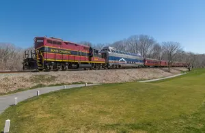
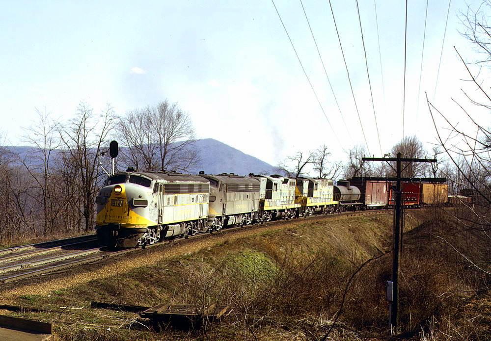 A pair of Clinchfield F7A's, led by #814, along with a pair of Geeps are about to lead their mixed freight into Ridge Tunnel along the Loops, deep within Western North Carolina's Appalachian region, during November of 1971. Warren Calloway photo.
History
To understand how the Loops were constructed one needs to look at the history of the Carolina, Clinchfield & Ohio Railway. When it was finally completed, the CC&O was one of the last major mountain railroads opened in the United States.
However, proposals for this corridor dated as far back as the industry's earliest days, during the 1830s, to have rails connecting the Ohio Valley at Cincinnati with Charleston, South Carolina.
At A Glance
The first company with serious intentions of making this route happen was chartered in 1886; the Charleston, Cincinnati & Chicago Railroad otherwise known as the "Three Cs."
Thanks to an initial strong financial backing the CC&C was able to quickly build more than 150 miles of railroad connecting Marion, North Carolina to Camden, South Carolina by 1889.
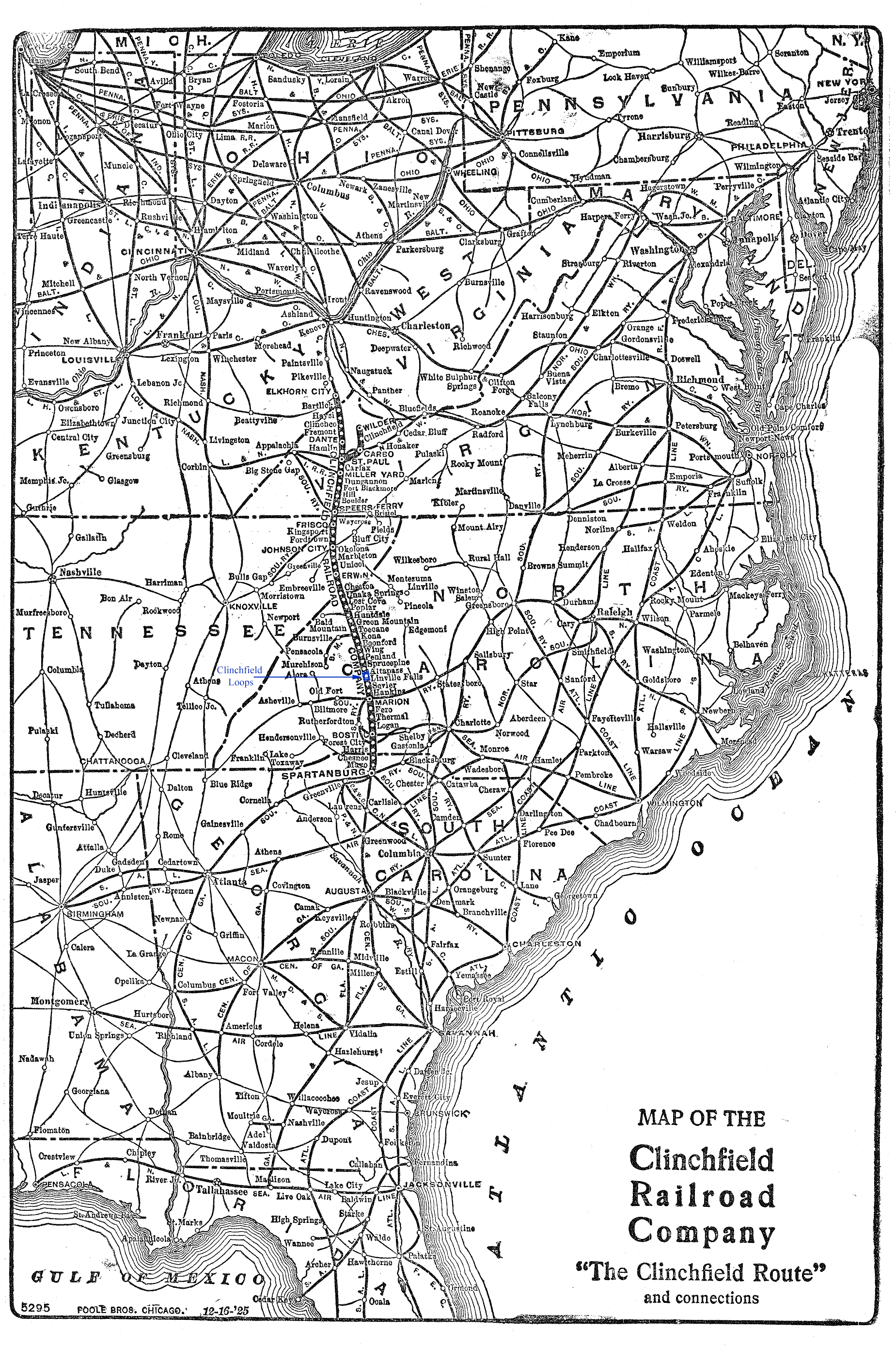
Map
The road was working on its northern extension into Kentucky during 1890 when a major bank financing the project failed and forced the line into bankruptcy. The project died at this point as the property was cut up and sold in 1898 among the Southern Railway and Chesapeake & Ohio.
Four years later the project again came back to life when George Carter formed the South & Western Railroad in 1902. Under his leadership, and an ability to secure financial backing for the project, the present-day Clinchfield main line was completed.
By 1904 Carter had opened a 62.8-mile line between Johnson City, Tennessee and Spruce Pine, North Carolina. The most difficult issue in building any further north was simply in battling for the right-of-way with the C&O through the Big Sandy River valley in Kentucky known as the "Battle Of The Breaks."
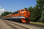
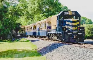
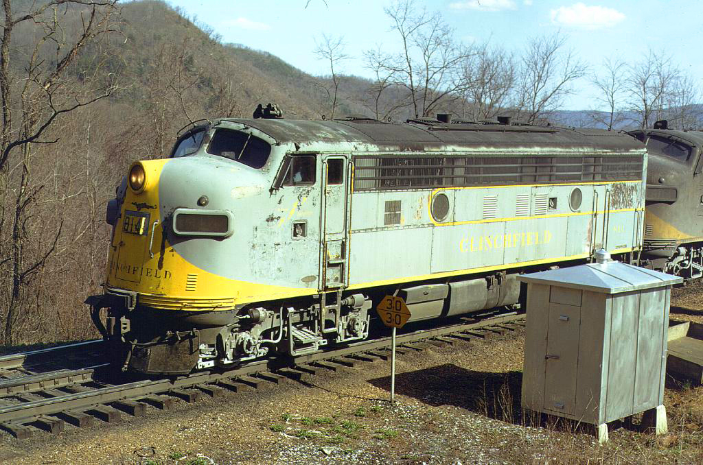 Clinchfield F7A #814 is ahead of a long manifest freight at appropriately-named Ridge, North Carolina on November 2, 1971. Warren Calloway photo.
Construction
Carter would eventually win this fight in the courts and later established an interchange with the C&O at what became the Clinchfield's northern terminus in Elkhorn City. By 1908 the S&W had built 35.8 miles of new railroad to Marion, North Carolina giving it a main line of 98.2 miles.
It was this section of the route in which the famed Clinchfield Loops are located. Carter believed that the railroad should be constructed to a very high standard, which was especially difficult considering it would be built through the southern Appalachians.
Throughout construction steel was used in erecting bridges, not wood (unless it was a temporary structure), tunnels featured dimensions of 18-feet across and 24-high (much larger than standard designs called for), and the road's chief engineers wanted the line set to a maximum grade of just 1.2% when the standard mountain grades of the era were commonly set to 2%.
The Clinchfield Loops defined this high level of engineering. They begin just south of Altapass, North Carolina (Spruce Pine) and feature a series of five horseshoe curves that includes seventeen tunnels in just 12 miles!
Even more fascinating is the fact that to keep grades at 1.2%, the loops feature 29 railroad miles when in fact they only travel an actual 12 miles from north to south.
As the book, A History of Railroading in Western North Carolina by Cary Poole points out, during one stretch of the line between milepost 208 to Wasburn Tunnel a train must negotiate 16.5 miles of railroad while if one could walk this in a straight line it would only be 1.9 miles.
In all, Carter's railroad featured 55 tunnels (totaling nearly 10 miles in length), 80 bridges (totaling 3.3. miles in length), and cost between $200,000-$1,000,000 per mile (an exorbitant amount for that time period, which likely would not have been justified today).
Tunnels
The below information is gleaned from Trains Magazine's article, "Men Against Mountains" by Ron Flanary, featured in the October, 2001 issue. The tunnels are listed from north to south. Note that these are only the tunnels on the Clinchfield Loops and does not represent all tunnels across the Clinchfield system!
Tunnel
1. Pine Ridge
2. Bridle Path
3. First Washburn
4. Second Washburn
5. Quinn's Knob
6. Third Washburn
7. Snipe's
8. Lower Bridle Path
9. Speedy
10. Lower Pine Ridge
11. Byrd
12. First Rocky
13. Second Rocky
14. Third Rocky (Removed in 1976)
15. Fourth Rocky
Length
1,600 Feet
927 Feet
770 Feet
363 Feet
545 Feet
915 Feet
637 Feet
1,618 Feet
288 Feet
2,211 Feet
341 Feet
716 Feet
757 Feet
420 Feet
1,688 Feet
After the line was completed to Marion the company was renamed as the Carolina, Clinchfield & Ohio although another seven years of construction were required before the railroad was opened officially by George Carter himself during a golden spike ceremony on February 9, 1915 between Elkhorn City and Spartanburg, South Carolina.
The CC&O's entire main line stretched just 276.9 miles but it was built to such high standards that it was an industrial marvel. Coal became the staple of the road, a commodity it could move in significant numbers thanks to the forward thinking of its designers.
Additionally, the Clinchfield had connections with the Atlantic Coast Line, Louisville & Nashville, C&O, Norfolk & Western, Interstate Railroad, Yancey Railroad, and East Tennessee & Western North Carolina.
Today
Eventually, the Clinchfield was acquired by the L&N and then passed into the Family Lines system, merged into the Seaboard System, and disappeared into CSX Transportation during the 1980s. Under CSX the route remained an important corridor until the fall of 2015.
That October, as a result of more than $1 billion in coal tonnage declines since 2012 the railroad mothballed the line between Elkhorn City, Kentucky and Spartanburg, South Carolina. Interesting, this move proved short-lived. Under the new direction of then-CEO and President E. Hunter Harrison, CSX re-opened the old Clinchfield as a through route.
It was part of his patented "Precision Schedule Railroading" concept. Test trains began on April 8, 2017 and traffic picked up significantly in the fall of that year. Part of Harrison's plan called for fewer hump yards which shifted traffic patterns on CSX. As a result, the Clinchfield is now used a type of relief valve corridor, thus reducing pressure over other areas of the network.
Sources
- Helm, Robert A. Clinchfield Railroad In the Coal Fields, The. Lynchburg: TLC Publishing, Inc., 2004.
Recent Articles
-
Maryland Ice Cream Tasting Train Rides
Feb 05, 26 10:07 PM
 Among WMSR's shorter outings, one event punches well above its “simple fun” weight class: the Ice Cream Train.
 -
North Carolina Beer Tasting Train Rides
Feb 05, 26 01:28 PM
 If you’re looking for the most “Bryson City” way to combine railroading and local flavor, the Smoky Mountain Beer Run is the one to circle on the calendar.
 -
Indiana Beer Tasting Train Rides
Feb 05, 26 11:26 AM
 On select dates, the French Lick Scenic Railway adds a social twist with its popular Beer Tasting Train—a 21+ evening built around craft pours, rail ambience, and views you can’t get from the highway.
 -
Ohio Whiskey Tasting Train Rides
Feb 05, 26 10:36 AM
 LM&M's Bourbon Train stands out as one of the most distinctive ways to enjoy a relaxing evening out in southwest Ohio: a scenic heritage train ride paired with curated bourbon samples and onboard refr…
 -
North Carolina Whiskey Tasting Train Rides
Feb 05, 26 10:34 AM
 One of the GSMR's most distinctive special events is Spirits on the Rail, a bourbon-focused dining experience built around curated drinks and a chef-prepared multi-course meal.
 -
Virginia Ale Tasting Train Rides
Feb 05, 26 10:30 AM
 Among Virginia Scenic Railway's lineup, Ales & Rails stands out as a fan-favorite for travelers who want the gentle rhythm of the rails paired with guided beer tastings, brewery stories, and snacks de…
 -
Colorado St. Patrick's Day Train Rides
Feb 04, 26 01:52 PM
 Once a year, the D&SNG leans into pure fun with a St. Patrick’s Day themed run: the Shamrock Express—a festive, green-trimmed excuse to ride into the San Juan backcountry with Guinness and Celtic tune…
 -
Utah St. Patrick's Day Train Rides
Feb 04, 26 12:19 PM
 When March rolls around, the Heber Valley adds an extra splash of color (green, naturally) with one of its most playful evenings of the season: the St. Paddy’s Train.
 -
Washington Whiskey Tasting Train Rides
Feb 04, 26 10:28 AM
 Climb aboard the Mt. Rainier Scenic Railroad for a whiskey tasting adventure by train!
 -
Connecticut Whiskey Tasting Train Rides
Feb 04, 26 10:11 AM
 While the Naugatuck Railroad runs a variety of trips throughout the year, one event has quickly become a “circle it on the calendar” outing for fans of great food and spirited tastings: the BBQ & Bour…
 -
Maryland Whiskey Tasting Train Rides
Feb 04, 26 10:06 AM
 You can enjoy whiskey tasting by train at just one location in Maryland, the popular Western Maryland Scenic Railroad based in Cumberland.
 -
Washington St. Patrick's Day Train Rides
Feb 03, 26 04:30 PM
 If you’re going to plan one visit around a single signature event, Chehalis-Centralia Railroad’s St. Patrick’s Day Dinner Train is an easy pick.
 -
California Whiskey Tasting Train Rides
Feb 03, 26 01:25 PM
 There is currently just one location in California offering whiskey tasting by train, the famous Skunk Train in Fort Bragg.
 -
Alabama Whiskey Tasting Train Rides
Feb 03, 26 01:13 PM
 With a little planning, you can build a memorable whiskey-and-rails getaway in the Heart of Dixie.
 -
Tennessee St. Patrick's Day Train Rides
Feb 03, 26 01:04 PM
 If you want the museum experience with a “special occasion” vibe, TVRM’s St. Patrick’s Day Dinner Train is one of the most distinctive ways to do it.
 -
Indiana Bourbon Tasting Trains
Feb 03, 26 11:13 AM
 The French Lick Scenic Railway's Bourbon Tasting Train is a 21+ evening ride pairing curated bourbons with small dishes in first-class table seating.
 -
Pennsylvania Whiskey Tasting Train Rides
Feb 03, 26 09:35 AM
 For whiskey aficionados and history buffs alike, a train ride through the Keystone State offering such spirits provides a unique and memorable experience.
 -
Massachusetts Dinner Train Rides On Cape Cod
Feb 02, 26 12:22 PM
 The Cape Cod Central Railroad (CCCR) has carved out a special niche by pairing classic New England scenery with old-school hospitality, including some of the best-known dining train experiences in the…
 -
Maine's Dinner Train Rides In Portland!
Feb 02, 26 12:18 PM
 While this isn’t generally a “dinner train” railroad in the traditional sense—no multi-course meal served en route—Maine Narrow Gauge does offer several popular ride experiences where food and drink a…
 -
Oregon St. Patrick's Day Train Rides
Feb 02, 26 12:16 PM
 One of the Oregon Coast Scenic's most popular—and most festive—is the St. Patrick’s Pub Train, a once-a-year celebration that combines live Irish folk music with local beer and wine as the train glide…
 -
Connecticut Wine Tasting Train Rides
Feb 02, 26 12:13 PM
 If you’re looking for a signature “special occasion” experience, the Essex Steam Train's Wine & Chocolate Dinner Train stands out as a decadent, social, and distinctly memorable take on dinner on the…
 -
Massachusetts St. Patrick's Day Train Rides
Feb 02, 26 12:12 PM
 Among Cape Cod Central's themed events, the St. Patrick’s Day Brunch Train stands out as one of the most fun ways to welcome late winter’s last stretch.
 -
Florida's Thomas The Train Rides
Feb 02, 26 11:53 AM
 Each year, Day Out With Thomas™ turns the Florida Railroad Museum in Parrish into a full-on family festival built around one big moment: stepping aboard a real train pulled by a life-size Thomas the T…
 -
California's Thomas The Train Rides
Feb 02, 26 11:45 AM
 Held at various railroad museums and heritage railways across California, these events provide a unique opportunity for children and their families to engage with their favorite blue engine in real-li…
 -
Nevada Dinner Train Rides At Ely!
Feb 02, 26 09:52 AM
 If you’ve ever wished you could step through a time portal into the hard-working world of a 1900s short line the Nevada Northern Railway in Ely is about as close as it gets.
 -
Michigan Dinner Train Rides At Owosso!
Feb 02, 26 09:35 AM
 The Steam Railroading Institute is best known as the home of Pere Marquette #1225 and even occasionally hosts a dinner train!
 -
Virginia ~ Murder Mystery ~ Dinner Train Rides
Feb 01, 26 01:08 PM
 Among the state's railroad attractions, murder mystery dinner trains stand out as a captivating fusion of theatrical entertainment, fine dining, and scenic travel.
 -
Maryland ~ Murder Mystery ~ Dinner Train Rides
Feb 01, 26 12:29 PM
 Maryland is known for its scenic landscapes, historical landmarks, and vibrant culture, but did you know that it’s also home to some of the most thrilling murder mystery dinner trains?
 -
North Carolina St. Patrick's Day Train Rides
Feb 01, 26 12:21 PM
 If you’re looking for a single, standout experience to plan around, NCTM's St. Patrick’s Day Train is built for it: a lively, evening dinner-train-style ride that pairs Irish-inspired food and drink w…
 -
Connecticut St. Patrick's Day Train Rides
Feb 01, 26 12:19 PM
 Among RMNE’s lineup of themed trains, the Leprechaun Express has become a signature “grown-ups night out” built around Irish cheer, onboard tastings, and a destination stop that turns the excursion in…
 -
Alabama's Valentine's Train Rides
Feb 01, 26 12:17 PM
 The Heart of Dixie Railroad Museum (HoDRM) is the kind of place where history isn’t parked behind ropes—it moves. This includes Valentine's Day weekend, where the museum hosts a wine pairing special.
 -
Florida's Valentine's Train Rides
Feb 01, 26 11:25 AM
 For couples looking for something different this Valentine’s Day, the museum’s signature romantic event is back: the Valentine Limited, returning February 14, 2026—a festive evening built around a tra…
 -
Connecticut's Valentine's Train Rides
Feb 01, 26 11:03 AM
 Operated by the Valley Railroad Company, the attraction has been welcoming visitors to the lower Connecticut River Valley for decades, preserving the feel of classic rail travel while packaging it int…
 -
Virginia's Valentine's Train Rides
Feb 01, 26 11:00 AM
 If you’ve ever wanted to slow life down to the rhythm of jointed rail—coffee in hand, wide windows framing pastureland, forests, and mountain ridges—the Virginia Scenic Railway (VSR) is built for exac…
 -
Maryland's Valentine's Train Rides
Feb 01, 26 10:54 AM
 The Western Maryland Scenic Railroad (WMSR) delivers one of the East’s most “complete” heritage-rail experiences: and also offer their popular dinner train during the Valentine's Day weekend.
 -
Massachusetts ~ Wine Tasting ~ Train Rides
Feb 01, 26 10:27 AM
 This article dives into some of the alluring aspects of wine by rail in Massachusetts, currently offered by the Cape Cod Central Railroad.
 -
Kentucky Dinner Train Rides At Bardstown
Jan 31, 26 02:29 PM
 The essence of My Old Kentucky Dinner Train is part restaurant, part scenic excursion, and part living piece of Kentucky rail history.
 -
Arizona Dinner Train Rides From Williams!
Jan 31, 26 01:29 PM
 While the Grand Canyon Railway does not offer a true, onboard dinner train experience it does offer several upscale options and off-train dining.
 -
Washington "Valentine's" Train Rides
Jan 31, 26 12:02 PM
Whether you’re a dedicated railfan chasing preserved equipment or a couple looking for a memorable night out, CCR&M offers a “small railroad, big experience” vibe—one that shines brightest on its spec… -
Georgia "Valentine's" Train Rides
Jan 31, 26 11:55 AM
 If you’ve ridden the SAM Shortline, it’s easy to think of it purely as a modern-day pleasure train—vintage cars, wide South Georgia skies, and a relaxed pace that feels worlds away from interstates an…
 -
Maryland ~ Wine Tasting ~ Train Rides
Jan 31, 26 11:49 AM
 This article delves into the enchanting world of wine tasting train experiences in Maryland, providing a detailed exploration of their offerings, history, and allure.
 -
Colorado ~ Wine Tasting ~ Train Rides
Jan 31, 26 11:40 AM
 To truly savor these local flavors while soaking in the scenic beauty of Colorado, the concept of wine tasting trains has emerged, offering both locals and tourists a luxurious and immersive indulgenc…
 -
Iowa's ~ Wine Tasting ~ Train Rides
Jan 31, 26 11:34 AM
 The state not only boasts a burgeoning wine industry but also offers unique experiences such as wine by rail aboard the Boone & Scenic Valley Railroad.
 -
Minnesota ~ Murder Mystery ~ Dinner Train Rides
Jan 31, 26 11:24 AM
 Murder mystery dinner trains offer an enticing blend of suspense, culinary delight, and perpetual motion, where passengers become both detectives and dining companions on an unforgettable journey.
 -
Georgia ~ Murder Mystery ~ Dinner Train Rides
Jan 31, 26 11:23 AM
 In the heart of the Peach State, a unique form of entertainment combines the thrill of a murder mystery with the charm of a historic train ride.
 -
Colorado's ~ Murder Mystery ~ Dinner Train Rides
Jan 31, 26 11:15 AM
 Nestled among the breathtaking vistas and rugged terrains of Colorado lies a unique fusion of theater, gastronomy, and travel—a murder mystery dinner train ride.
 -
Colorado "Valentine's" Train Rides
Jan 30, 26 11:02 AM
 The Royal Gorge Route Railroad is the kind of trip that feels tailor-made for railfans and casual travelers alike, including during Valentine's weekend.
 -
Massachusetts "Valentine's" Train Rides
Jan 30, 26 10:37 AM
 The Cape Cod Central Railroad (CCCR) blends classic New England scenery with heritage equipment, narrated sightseeing, and some of the region’s best-known “rails-and-meals” experiences.
 -
California "Valentine's" Train Rides
Jan 30, 26 10:34 AM
 Operating out of West Sacramento, this excursion railroad has built a calendar that blends scenery with experiences—wine pours, themed parties, dinner-and-entertainment outings, and seasonal specials…
 -
Kansas Dinner Train Rides In Abilene
Jan 30, 26 10:27 AM
 If you’re looking for a heritage railroad that feels authentically Kansas—equal parts prairie scenery, small-town history, and hands-on railroading—the Abilene & Smoky Valley Railroad delivers.


%20from%20the%20Clinchfield%20Railroad's%201925%20system%20map.%20%20Author's%20collection.)