
Horseshoe Curve (Pennsylvania): Map, Photos, History, Operation
Last revised: August 24, 2024
By: Adam Burns
There are many horseshoe curves throughout North America such as Milwaukee Road's Vendome Loop (abandoned), Western Maryland's Helmstetter's Curve, Santa Fe's Cajon Pass, and Canadian Pacific's Crowsnest Pass.
However, for most the term "Horseshoe Curve" describes a singular place, Pennsylvania Railroad's (PRR) legendary crossing of the Allegheny Mountains within its home state.
History
It was the company's final effort in completing its original, Harrisburg-to-Pittsburgh main line.
The project was spearheaded by PRR president John Edgar Thomson (also the railroad's first chief engineer) in an exhaustive effort to maintain the lowest possible grades through the rugged Appalachian Mountains.
His ingenious design was so remarkable it eventually earned National Historic Landmark status and became not only a popular PRR location but also a nationwide attraction. Today, it still plays hosts to thousands of visitors and remains a vital artery of successor Norfolk Southern.
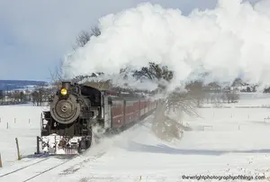
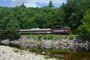
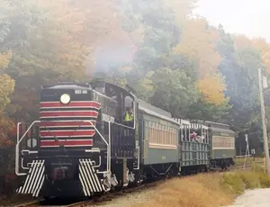
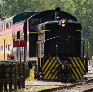
 Penn Central SD40 #6040 and SD45 #6204 work helper service on Horseshoe Curve on February 23, 1969. Roger Puta photo.
The state of Pennsylvania was rushing to improve its transportation arteries following the Erie Canal's 1825 opening, as well as various early railroads (notably the Baltimore & Ohio).
The legislature authorized construction of its own canal, known as the Pennsylvania Canal, on February 25, 1826.
Originally projected to link Harrisburg with Pittsburgh, plans were later amended for an eastern extension into Philadelphia.
With railroad fever growing, the state slightly modified the original concept by having engineers devise an interesting system of interlinking railroads and waterways, collectively known as the Main Line of Public Works (MLoPW).
While successful, by the time the 395-mile network was fully in service the iron horse was already proving itself operationally superior. From east to west the MLoPW consisted of:
- The 82-mile Philadelphia & Columbia Railroad (Originally incorporated as the Philadelphia, Lancaster & Columbia Rail Road in 1826 to link Quaker City with Columbia, it was the oldest railroad component of the modern PRR.) completed between Philadelphia and Columbia in 1834.
- The 172-mile Pennsylvania Canal linking Columbia and Hollidaysburg which opened in 1832.
- The 36-mile, incline plane Allegheny Portage Railroad from Hollidaysburg to Johnstown finished in 1834.
- The 104-mile Western Division Canal completed between Johnstown and Pittsburgh in 1830.
The B&O was a particular threat as the pioneering road served Baltimore, situated very near Philadelphia.
As cities all along the east coast fought for dominance in the Atlantic trade, Pennsylvania worried it would be eclipsed by its next door neighbor.
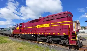
 It's the very early Penn Central era as SD45 #6204 and 6204 and SD40 #6040, run light between helper assignments on Horseshoe Curve on February 23, 1969. Roger Puta photo.
Pennsylvania Railroad
The legislature hurriedly formed the Pennsylvania Railroad in 1846 and work soon began on an all-rail corridor across the state. Entire libraries could be written on the "Pennsy," ranging from its corporate history and locomotive classes to non-rail business interests and economic impact.
For more than 120 years its Keystone logo was not only a symbol of Pennsylvania but also a corporate pillar in American commerce. For this reason, the PRR remains an institution to Philadelphia and Pennsylvania.
Ironically, despite bringing about its creation, the state had mixed feelings towards the newly incorporated railroad; if completed, it would almost assuredly prove its publicly-funded MLoPW redundant.
John Edgar Thomson, Chief Engineer
Nevertheless, the PRR project moved forward. Its chief engineer, John Edgar Thomson (appointed to the post on April 9, 1847), was tasked with selecting the best of three routes surveyed by George Schlatter in 1839.
Photos
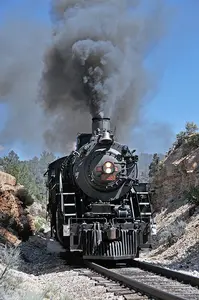
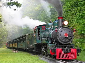
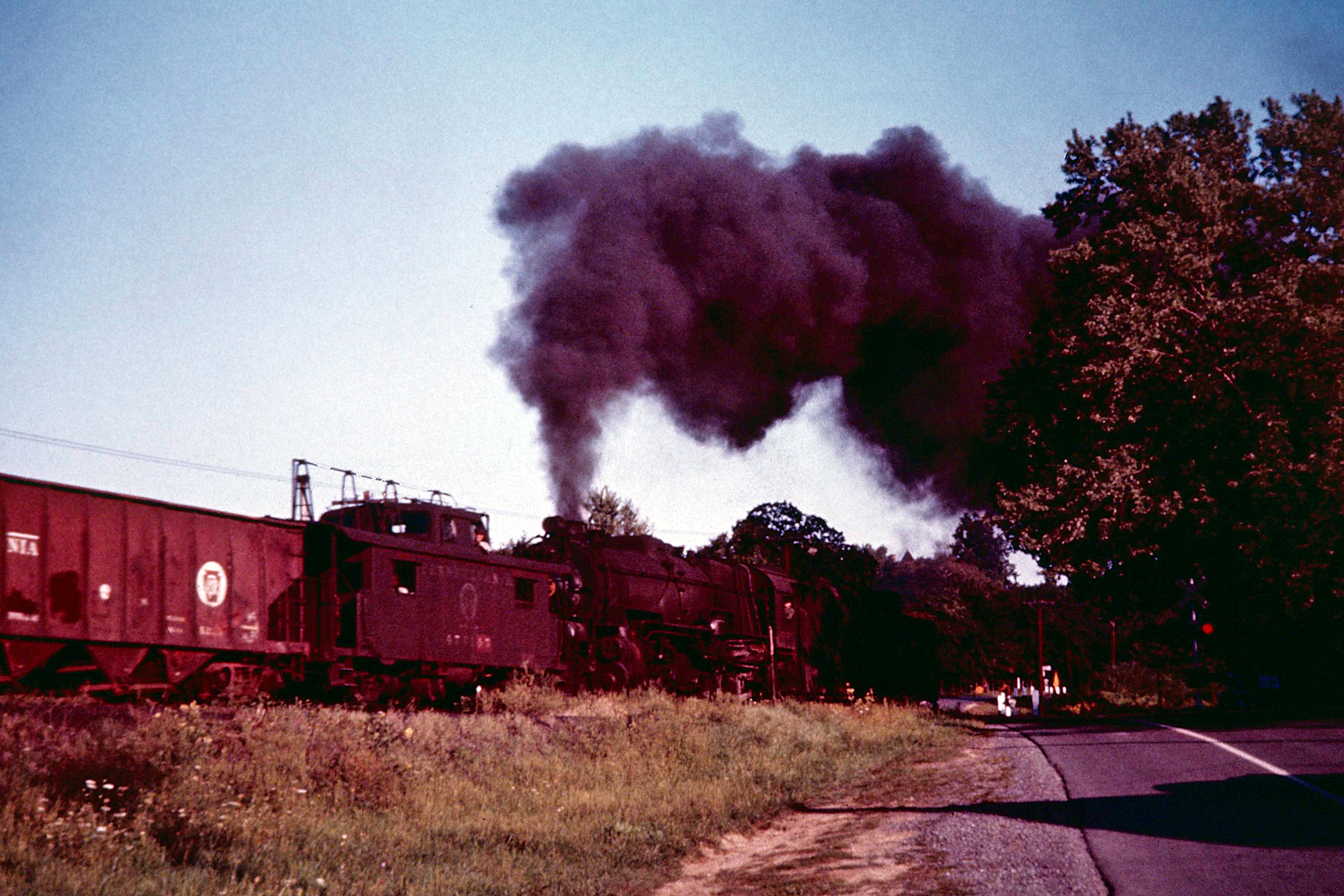 Pennsylvania 2-8-2 #6894 in helper service near Horseshoe Curve. Philip Hastings photo. American-Rails.com collection.
Following much deliberation he concluded the central corridor ideal; it was the most direct with the lowest grades.
The line would follow the Susquehanna River north to the Juanita River where it turned due west all of the way to Petersburg before veering slightly northwest and then south into Altoona via the Little Juanita River.
What was known as PRR's Eastern Division, from Harrisburg to Ducansville, was opened for service by October, 1850.
Alignment
At the latter point a connection was established with the state's Allegheny Portage Railroad. With this segment's completion the PRR began work on its Western Division.
It was built through the Allegheny Plateau and, once again, stuck largely to river valleys in an attempt to keep grades under 1.8%, as Thomson had directed.
From Pittsburgh, the line struck out northward along the Allegheny River before turning eastward at Freeport along the Kiskiminetas River.
At Saltsburg the waterway became known as the Conemaugh River and was followed all of the way to Portage, via Johnstown.
At the former point the Little Conemaugh River valley was utilized into Cresson. The final remaining obstacle was the impenetrable Allegheny Mountains, a barrier preventing easy connection of the two divisions.
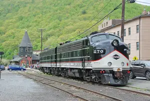
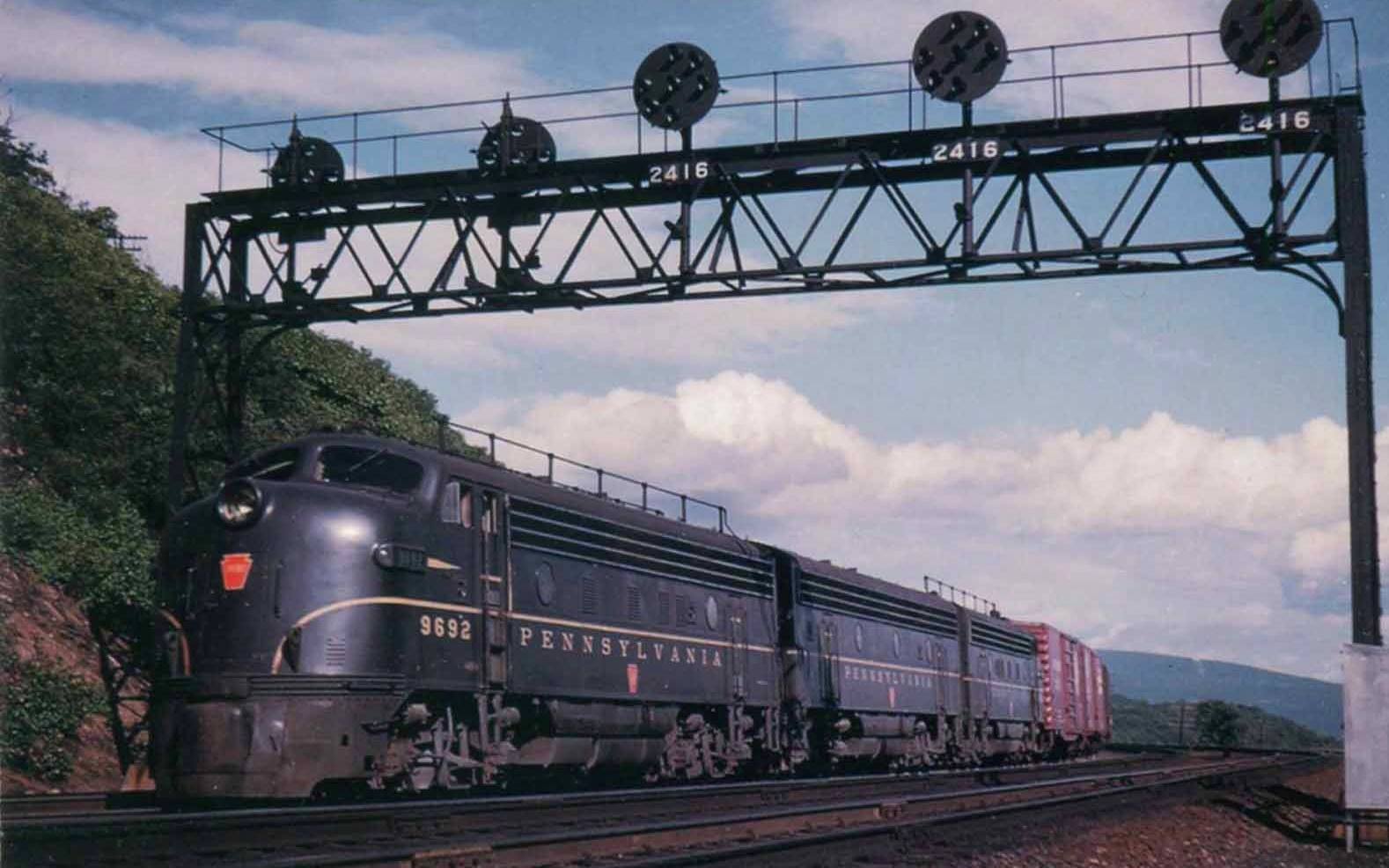 An A-B-A set of Pennsylvania F7's pass beneath the signal bridge as they climb the grade just west of Kittanning Point, Pennsylvania during the 1960's. The structures seen protruding from the A units' roof-lines was Pennsy's unique "Trainphone" system, used in the days prior to modern wireless radio.
There was no way around the mountain and no natural valley through it existed.
Thomson was forced to improvise while still maintaining the maximum grade he had set forth. What was dubbed the Mountain Division was very short (under 40 miles) although it became the railroad's most famous segment.
In their book, "Pennsylvania Railroad," authors Mike Schafer and Brian Solomon note that a direct alignment from Altoona to the mountain's eastern ridge would have required a brutal 4.5% grade.
Thomson also ran into a funding problem; although work had begun in 1851 he was unable to convince the state or railroad President William C. Patterson to provide financing for the line's completion.
Construction
A fervent believer in the PRR, Thomson used his influence to reach the presidency in 1852. Now controlling the reigns he quickly raised $3 million in bonds; the route subsequently headed west from the small hamlet of Altoona (officially incorporated on February 6, 1854), situated just over 7 miles north of Ducansville.
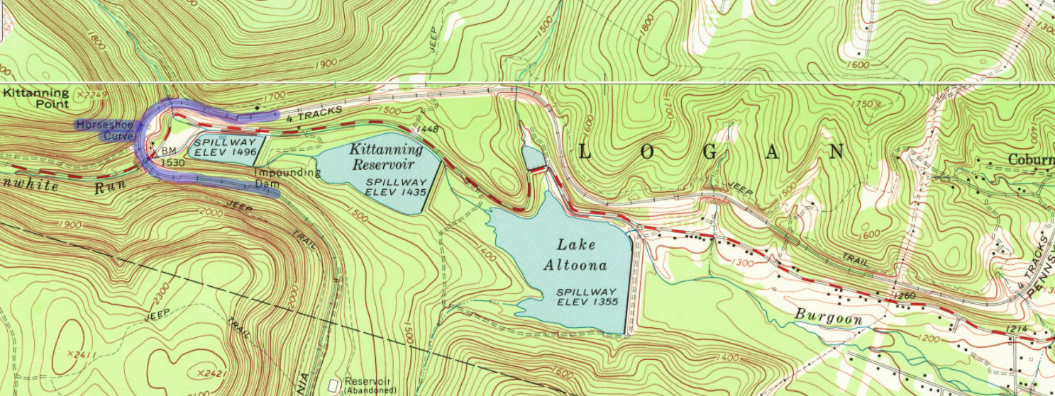
Following great deliberation Thomson and his engineers realized an alignment heading out of the valley along Burgoon Run, hugging the mountainside to a location known as Kittanning Point, and swinging around to the other side via a massive curve could maintain a grade of less than 1.8% into Cresson.
What became known as Horseshoe Curve was officially opened on February 15, 1854. In later years Burgoon Run was utilized as the city's reservoir, which still holds true today.
The article, "Horseshoe Curve: And Approach To Gallatzin Tunnels," from the May, 1952 edition of Trains Magazine, notes the grade through the curve totaled 1.45% (or 76.6 feet per mile) while the grade out of Altoona ascended 1.75% (or 92.4 feet per mile).
The curve itself is composed of two separate bends at slightly different radii. The northerly/easterly curve features a radius of 637 feet while the southerly/westerly curve holds a radius of 609 feet. Overall, the entire curve is 9 degrees.
Even into the diesel era, the PRR almost always utilized helpers for westbound freights as trains out Altoona would be 122 feet higher at the western approach (the western/southern "calk" is 1,716 feet high while the eastern/northern "calk" stands at 1,594 feet in height).
Beyond, the grade averages 1.729% to the summit at the Gallatzin Tunnels, which include PRR's original two bores as well as the Allegheny Portage Railroad's 2,000-foot New Portage Tunnel.
- The middle, originally known as the Summit Tunnel and now known as Allegheny Tunnel, is 3,612 feet in length and situated at an elevation of 2,167 feet.
It was completed by the PRR in 1854. Its northern counterpart is the newest, Gallatzin Tunnel, finished in 1904 and was also 3,612 feet in length. -
As the most southerly bore it was finished in 1855/1856, part of the state's endeavor to replace the incline plane railroad and improve its MLoPW. The route headed due west out of Ducansville via Blairs Gap Run and even included its own miniature horseshoe curve, known as Muleshoe Curve.
Maps
Unfortunately, the PRR's opening ruined the MLoPW. Just as the state had feared, the railroad's direct routing made its project superfluous; where once the PRR had to pay state tolls between Philadelphia and Lancaster, as well as from Duncansville to Cresson (to link its Eastern and Western Divisions) it purchased the MLoPW outright in 1857.
 Conrail helpers SD40-2 #6367 and SD40 #6336 round Horseshoe Curve in October, 1995. At right can be seen Pennsylvania GP9 #7048 on display. Karl Miller photo.
Operation
Much of the right-of-way was quickly abandoned although the New Portage Tunnel proved useful by handling eastbound traffic. This allowed the Allegheny [and later Gallatzin] Tunnel to move predominately westbound movements.
The PRR immediately saw a boom in freight and passenger traffic as Harrisburg-Pittsburgh travel times were reduced to only 13 hours. In the early years the location was marketed as the "Horseshoe Curve Route" and as the PRR grew it turned into a popular tourist attraction.
The Steel City blossomed into an industrial powerhouse and PRR's gateway to the west where acquisitions allowed it to eventually reach Chicago and St. Louis.
The Pennsy quickly eclipsed the B&O and in time became the most powerful eastern trunk line, even besting Cornelius Vanderbilt's future New York Central & Hudson River empire. While the route initially featured only one track it later grew to four.
 "The Horseshoe Curve." Artwork by Grif Teller, featured in the Pennsylvania Railroad's 1952 annual calendar.
In addition, Altoona was selected as PRR's primary locomotive and maintenance shops. Known as the Altoona Works, Harry T. Sohlberg notes in his article "Horseshoe Curve" from the March, 1941 issues of Trains Magazine its roundhouse was a complete circle with 50 engine-house pits capable of storing 385 locomotives.
There was also the Juanita Shops, Altoona Machine Shops, Altoona Car Shops, South Altoona Foundries, Test Department, and Locomotive Test Plant. Today, while somewhat scaled down it remains open under Norfolk Southern.
In addition, the nearby Railroaders Memorial Museum highlights the history of this facility, the region's rail heritage (including Horseshoe Curve), and the role railroaders have played within America.
Today, the curve includes only three tracks. Due to the decline of passenger trains, Conrail removed one track following its 1976 startup.
In any event, the location remains as busy as ever, hosting more than 50 freight trains and a few Amtrak services per day. To read more about the Pennsylvania Railroad please click here.
Since 1879 a park dedicated to the engineering marvel has been located in the bowl of the curve. In 1932 an access road was completed to the park and in 1957 the PRR dedicated a retired 4-6-2 steam locomotive (Class K4s #1361) at the park (it has since been replaced by Pennsylvania Railroad GP9 #7048).
On November 13, 1966 the curve was adorned with the rare status as a National Historic Landmark and in the late 1980s the National Park Service became involved by permanently maintaining the park's facilities and grounds.
Recent Articles
-
Maine 'Dinner Train' Rides At Portland
May 29, 26 12:04 PM
 While this isn’t generally a “dinner train” railroad in the traditional sense—no multi-course meal served en route—Maine Narrow Gauge does offer several popular ride experiences where food and drink a…
 -
Nevada 'Dinner Train' Rides From Ely
May 29, 26 12:01 PM
 If you’ve ever wished you could step through a time portal into the hard-working world of a 1900s short line the Nevada Northern Railway in Ely is about as close as it gets.
 -
Connecticut 'Murder Mystery' Dinner Train Rides
May 29, 26 11:57 AM
 All aboard the intrigue express! One location in Connecticut typically offers a unique and thrilling experience for both locals and visitors alike, murder mystery trains.
 -
Alabama 'Wine Tasting' Train Rides
May 29, 26 11:51 AM
 While the state might not be the first to come to mind when one thinks of wine or train travel, the unique concept of wine tasting trains adds a refreshing twist to the Alabama tourism scene.
 -
Washington 'Wine Tasting' Train Rides
May 29, 26 11:48 AM
 Here’s a detailed look at where and how to ride, what to expect, and practical tips to make the most of wine tasting by rail in Washington.
 -
Colorado "Wild West" Train Rides
May 29, 26 11:36 AM
 If there’s one weekend (or two) at the Colorado Railroad Museum that captures that “living history” spirit better than almost anything else, it’s Wild West Days.
 -
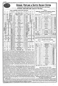
SP&S Railway Timetables (August, 1952)
May 29, 26 09:45 AM
 The information presented here highlights the Spokane, Portland & Seattle Railway's timetables from the August, 1952 edition of the "Official Guide."
 -
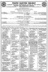
Pacific Electric Railway Timetables (January, 1930)
May 28, 26 11:20 PM
 Featured here is the Pacific Electric's timetables listed in the January, 1930 edition of the "Official Guide Of The Railways."
 -
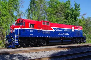
Delaware-Lackawanna Unveils Heritage M630 1776
May 28, 26 01:32 PM
 Genesee Valley Transportation Co., Inc. and “the” Delaware-Lackawanna Railroad Co. Inc. are proud to debut the historic repaint of locomotive #1776, at the D-L’s Von Storch shop in Scranton Pennsylvan…
 -
Michigan Independence Day Train Rides
May 28, 26 01:11 PM
 Each year on Independence Day, the Crossroads Village/Huckleberry Railroad comes alive with a special celebration that blends patriotism, family fun, and old-fashioned charm.
 -
Maryland Independence Day Train Rides
May 28, 26 11:37 AM
 The Walkersville Southern Railroad delivers a charming slice of railroad history through scenic excursions and themed special events. One of its most anticipated annual highlights is the Fireworks Tra…
 -
Kentucky "Wild West" Train Rides
May 28, 26 11:20 AM
 One of KRM’s most crowd-pleasing themed events is “The Outlaw Express,” a Wild West train robbery ride built around family-friendly entertainment and a good cause.
 -
Pennsylvania 'Wild West' Train Rides
May 28, 26 11:10 AM
 The Keystone State is home to a variety of historical attractions, but few experiences can rival the excitement and nostalgia of a Wild West train ride.
 -
Florida 'Wild West' Train Rides
May 28, 26 11:06 AM
 This article delves into wild west rides throughout Florida, the historical context surrounding them, and their undeniable charm.
 -
STB Accepts Revised Union Pacific-Norfolk Merger Application
May 28, 26 11:03 AM
 In a significant development for the U.S. freight rail industry, the Surface Transportation Board (STB) today accepted for consideration the revised major merger application filed by Union Pacific Cor…
 -
West Virginia 'Wild West' Train Rides
May 27, 26 01:26 PM
 While D&GV is known for several different excursions across the region, one of the most entertaining rides on its calendar is the Greenbrier Express Wild West Special.
 -
Arizona 'Wild West' Train Rides
May 27, 26 01:22 PM
 Let's delve into the captivating world of Arizona's Wild West train adventures, currently offered at the popular Grand Canyon Railway.
 -
Michigan 'Wild West' Train Rides
May 27, 26 01:18 PM
 While the term 'wild west' often conjures up images of dusty plains and expansive deserts, Michigan offers its own unique take on this thrilling period of history.
 -
Wisconsin 'Wild West' Train Rides
May 27, 26 01:15 PM
Through a unique blend of interactive entertainment and historical reverence, Wisconsin offers a captivating glimpse into the past with its Wild West train rides. -
Missouri "Father's Day" Train Rides
May 27, 26 01:01 PM
 If you're looking for a unique way to honor your dad this year, why not consider a scenic and historical train ride?
 -
Maryland "Father's Day" Train Rides
May 27, 26 11:38 AM
 Maryland offers some unique and picturesque train rides, including the Walkersville Southern that celebrates dad each June!
 -
Northwestern Steel & Wire: 1936 - 2001
May 26, 26 10:52 PM
 Northwestern Steel & Wire was a major steel manufacturer located in Sterling, Illinois operating from 1936-2001. It was also well known for its extensive industrial railroad, operating steam until 198…
 -
Amtrak Timetables (May, 1972)
May 26, 26 12:32 PM
 Presented here is Amtrak's complete timetable listing from the May, 1972 edition of "The Official Guide Of The Railways."
 -
Georgia 'Wild West' Train Rides
May 26, 26 12:22 PM
Nestled within its lush hills and historic towns, the Peach State offers unforgettable train rides that channel the spirit of the Wild West. -
New Hampshire Independence Day Train Rides
May 26, 26 12:17 PM
Climb aboard Granite State Railway's Firecracker Trains—a patriotic, family-friendly fireworks spectacular rolling right through the heart of New Hampshire's Lakes Region. -
Utah Independence Day Train Rides
May 26, 26 12:14 PM
 Every July, as America celebrates its birthday, the Heber Valley Railroad in Heber City, Utah, rolls out a special tradition: the Freedom Train.
 -
North Carolina "Wild West" Train Rides
May 26, 26 12:12 PM
 North Carolina, a state known for its diverse landscapes ranging from serene beaches to majestic mountains, offers a unique blend of history and adventure through its Wild West train rides.
 -
Pennsylvania 'Wild West' Train Rides
May 26, 26 12:00 PM
 The Keystone State is home to a variety of historical attractions, but few experiences can rival the excitement and nostalgia of a Wild West train ride.
 -
Maine "Father's Day" Train Rides
May 26, 26 11:46 AM
 This year for Father's Day, why not trade the conventional gifts and barbeque in for something exceptional—a scenic train ride across the beautiful state of Maine.
 -
Minnesota "Father's Day" Train Rides
May 26, 26 11:43 AM
 If you're in Minnesota and looking for a unique way to spend this day with your dad, consider taking a scenic train ride.
 -
Pennsylvania Independence Day Train Rides
May 25, 26 11:58 AM
 Pennsylvania’s rich railroad heritage comes alive every Independence Day, but 2026—the nation’s semiquincentennial—offers extra patriotic flair.
 -
Ohio 'Wild West' Train Rides
May 25, 26 11:40 AM
 For those enamored with tales of the Old West, Ohio's railroad experiences offer a unique blend of history, adventure, and natural beauty.
 -
New York 'Wild West' Train Rides
May 25, 26 11:37 AM
Join us as we explore wild west train rides in New York, bringing history to life and offering a memorable escape to another era. -
Kentucky "Father's Day" Train Rides
May 25, 26 11:34 AM
 Kentucky offers a variety of historic and scenic train excursions that provide an unforgettable way to honor and spend quality time with fathers.
 -
Kansas "Father's Day" Train Rides
May 25, 26 11:33 AM
In this guide, we'll explore some of the best train rides available for Father's Day in Kansas. -
Vermont Independence Day Train Rides
May 25, 26 11:21 AM
 On Independence Day, elements come together to offer a unique experience in Vermont: train rides that combine scenic beauty with patriotic celebrations.
 -
Georgia Independence Day Train Rides
May 24, 26 12:26 PM
 As the 4th of July approaches in 2026, the Blue Ridge Scenic Railway in Blue Ridge, Georgia, invites you to celebrate America in true patriotic style aboard its Firecracker Special.
 -
Illinois Independence Day Train Rides
May 24, 26 11:58 AM
 As America gears up for the 4th of July in 2026, the Illinois Railway Museum (IRM) in Union, Illinois, offers the perfect blend of patriotic festivities, family-friendly excitement, and living railroa…
 -
Alabama Independence Day Train Rides
May 24, 26 11:55 AM
 For those seeking a unique way to celebrate the Fourth of July, Alabama offers a distinctive experience: honoring veterans and active military personnel on Independence Day by train.
 -
Ohio Independence Day Train Rides
May 24, 26 11:47 AM
 In this guide, we will explore some of the best Independence Day train ride experiences available in Ohio.
 -
Alabama 'Wild West' Train Rides
May 24, 26 11:45 AM
 Although Alabama isn't the traditional setting for Wild West tales, the state provides its own flavor of historic rail adventures that draw enthusiasts year-round.
 -
Missouri 'Wild West' Train Rides
May 24, 26 11:29 AM
 In Missouri, a state rich in history and natural beauty, you can experience the thrill of a bygone era through the scenic and immersive Wild West train rides.
 -
Indiana 'Wild West' Train Rides
May 24, 26 11:27 AM
 Indiana offers a unique opportunity to experience the thrill of the Wild West through its captivating train rides.
 -
Independence Day Train Rides (2026): A Complete Guide
May 24, 26 11:25 AM
 Americans celebrate Independence Day with fireworks, barbecues, and parades, but there's another unique way to experience the spirit of freedom: train rides.
 -
Illinois 'Father's Day' Train Rides
May 24, 26 11:23 AM
 If you're in Illinois and searching for something distinctive, consider taking your dad on a train ride through the picturesque landscapes of the Prairie State.
 -
Florida 'Father's Day' Train Rides
May 24, 26 11:21 AM
 For those looking for something a little different this year, why not consider celebrating dad on Father's Day by train?
 -
South Dakota 'Beer Tasting' Train Rides
May 23, 26 12:51 PM
 While the 1880 Train's regular runs are a treat in any season, the Oktoberfest Express adds an extra layer of fun: German-inspired food, seasonal beer, and live polka set against the sound and spectac…
 -
Michigan 'Beer Tasting' Train Rides
May 23, 26 12:49 PM
 If you’re looking for a pure slice of autumn in West Michigan, the Coopersville & Marne Railway (C&M) has a themed excursion that fits the season perfectly: the Oktoberfest Exp…
 -
Indiana 'Murder Mystery' Dinner Train Rides
May 23, 26 12:47 PM
 This piece explores the allure of murder mystery trains and why they are becoming a must-try experience for enthusiasts and casual travelers alike.
 -
Maryland 'Ice Cream' Tasting Train Rides
May 23, 26 12:46 PM
 Among WMSR's shorter outings, one event punches well above its “simple fun” weight class: the Ice Cream Train.
%20from%20Pennsylvania%20Railroad's%201930%20system%20map.%20%20Author's%20collection.)