Panhandle Route: Pittsburgh, Cincinnati, Chicago & St. Louis Railroad
Last revised: August 13, 2026
By: Adam Burns
The Pittsburgh, Cincinnati, Chicago & St. Louis Railroad (PCC&StL)—better known as the Panhandle Route or simply “the Panhandle”—was one of the great western arms of the Pennsylvania Railroad. West of Pittsburgh it carried the Pennsy toward Columbus, Cincinnati, Indianapolis, St. Louis, and a secondary Chicago gateway via Logansport, stitching the industrial East to the Midwest under one operating culture of heavy freight, named passenger trains, and double-track ambition.
The nickname is geography, not marketing fluff. The earliest Pittsburgh–Ohio connection threaded the narrow northern panhandle of Virginia (after 1863, West Virginia) to reach the Ohio River at Steubenville. Once PRR-controlled lines spread west of that choke point, railroaders kept calling the whole system the Panhandle—even after the corporate title lengthened to include Chicago and St. Louis. At peak size the property counted on the order of 2,700 route-miles (about 1920), a multi-state web that mattered as much for coal, steel, and merchandise as for the Blue Ribbon passenger names that rolled over it.
This page expands the original American-Rails.com overview: how the corridor was forced through the panhandle, how predecessor companies became the PCC&StL, what the main routes were, how the line lived under PRR / Penn Central / Conrail, and what still carries trains—or bicycles—today.
On this page: At a glance · Why “Panhandle” · Building the corridor · Corporate timeline · Principal lines · Freight & junctions · Passenger trains · System maps · Under the Pennsy · PC, Conrail & today · Related reading
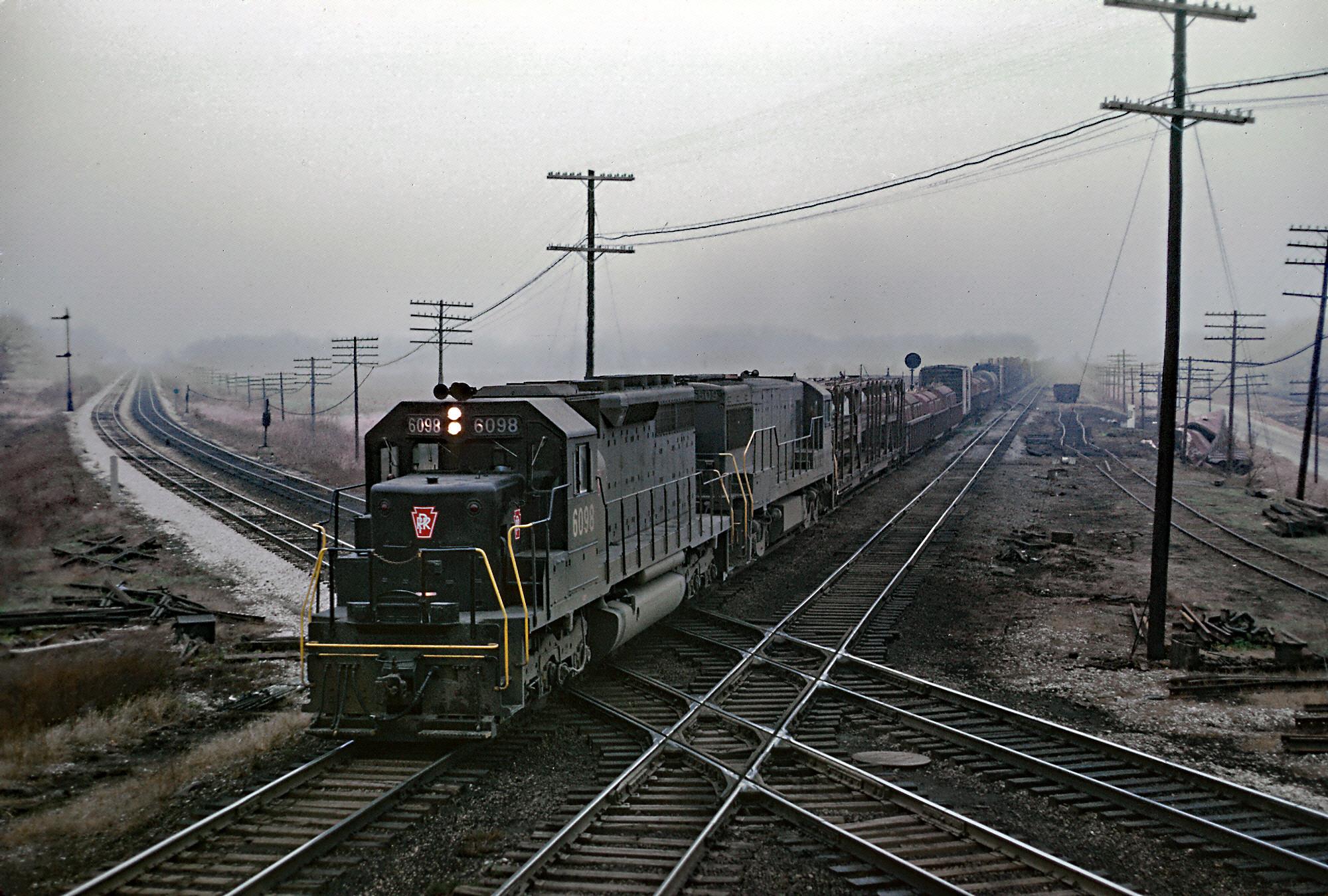
If you know Midwestern junctions, North Judson, Indiana, still means nostalgia. Four main lines once crossed here—Pennsylvania, Erie / Erie Lackawanna, Chesapeake & Ohio, and New York Central. Today those freights are gone. Pennsylvania SD40 #6098 rattles across the Erie Lackawanna diamond on the Panhandle’s Chicago–Logansport main with a manifest, November 25, 1966. Roger Puta photo.
At a Glance
| Item | Detail |
|---|---|
| Common name | Panhandle Route (also Pan Handle Route); corporate PCC&StL |
| Full corporate title | Pittsburgh, Cincinnati, Chicago and St. Louis Railroad |
| Headquarters | Pittsburgh, Pennsylvania (Penn Avenue and 10th Street in period listings) |
| States served (peak) | Pennsylvania, West Virginia, Ohio, Indiana, Illinois (plus Louisville gateway traffic via connecting PRR lines in Kentucky context) |
| Key formation date | September 30, 1890—consolidation creating the PCC&StL under that full title |
| PRR relationship | PRR-financed and controlled from the mid-19th century building era; long operated as a Lines West / Pennsylvania Company property; formal long-term lease commonly dated January 1, 1921; corporate merger into PRR family (Philadelphia, Baltimore & Washington) April 1956 (often cited April 1–2, 1956) |
| Route mileage (c. 1920) | About 2,700 |
| Primary role | PRR trunk west of Pittsburgh toward Columbus–Cincinnati–Indianapolis–St. Louis; secondary Chicago path via Columbus–Logansport; dense Ohio / Indiana branches and connections |
| Not the same as | PRR’s Fort Wayne line (Pittsburgh, Fort Wayne & Chicago)—another western main, often paired in conversation but a separate corporate/route story |
| Successors (operations) | PRR → Penn Central (1968) → Conrail (1976) → largely Norfolk Southern / CSX after 1999, plus short lines and trails on abandoned segments |
Glance figures follow the original American-Rails.com research base and standard PRR secondary literature (Schafer & Solomon; related Lines West summaries). Exact lease and merger statutory dates vary slightly by source; the operating reality was Pennsy control long before the 1956 paper consolidation.
Why It Was Called the Panhandle
Look at a map of West Virginia. The thin strip of counties between Pennsylvania and the Ohio River—Hancock, Brooke, and Ohio counties in the northern panhandle—is only a few miles wide. In the 1850s that strip still belonged to Virginia. Any railroad from Pittsburgh that wanted a short, competitive path to the Ohio River and then across Ohio toward Columbus had to cross it.
The engineering and legal fight to do so gave the corridor its permanent nickname. Even after the corporate family grew to St. Louis and Chicago, crews, managers, and the public still said Panhandle. The name stuck on timetables, maps, employee lore, and modern trail signs along abandoned segments near Pittsburgh. Understanding the nickname is the shortest way to understand the railroad: it was PRR’s bid to outflank rivals for Midwest traffic by owning a clean path west from the Steel City.
Building the Corridor: P&S, S&I, and Hollidays Cove
In Mike Schafer and Brian Solomon’s Pennsylvania Railroad, the Panhandle’s earliest Pittsburgh-side building block is the Pittsburgh & Steubenville (P&S). Chartered in the mid-19th century (often dated from a 1849 charter lineage) and advanced with PRR financing, the P&S aimed to link Pittsburgh with Steubenville, Ohio, via the Virginia panhandle. Construction of the key Pittsburgh–Ohio connection advanced in the mid-1850s; standard summaries place serious construction work from about 1856.
At Steubenville the plan was to meet the Steubenville & Indiana (S&I), another road in which the Pennsylvania held substantial stock from the mid-1850s (often cited from 1854). Together, P&S and S&I were intended to give the PRR a Pittsburgh–Columbus axis—and with further extensions, access toward Cincinnati and the Midwest—pulling freight and passengers away from the rival Baltimore & Ohio sphere in the Ohio Valley.
That plan nearly failed. The S&I’s 1864 bankruptcy threatened the western connection just as Civil War politics complicated anything involving Virginia territory. Completing the panhandle crossing required more than grading: Virginia resisted, and a combination of state-level struggle and federal pressure—including an act of Congress associated with forcing access across the panhandle—shaped the final solution.
The crucial local piece was the Hollidays Cove Railroad (also styled Holliday’s Cove), a short Virginia-chartered line (about 1860) built to carry the railroad across the panhandle to the Pennsylvania line and work with a new Ohio River bridge at Steubenville. In 1865 the Steubenville Extension package—bridge, Hollidays Cove link, and P&S connection—opened through service toward Columbus, roughly a 193-mile Pittsburgh–Columbus corridor in period descriptions. The PRR finally had its western door.
Related state context: West Virginia · Ohio · Pennsylvania Railroad.
Corporate Timeline: From Panhandle Railway to PCC&StL
| Year | Event |
|---|---|
| 1849+ | Pittsburgh & Steubenville charter lineage; PRR interest grows through the 1850s |
| 1854–56 | PRR stake in Steubenville & Indiana; P&S construction era toward the Ohio River |
| 1860 | Hollidays Cove Railroad chartered to cross the Virginia panhandle |
| 1864 | S&I bankruptcy jeopardizes the Columbus connection |
| 1865 | Steubenville Extension / bridge / panhandle link open through service toward Columbus |
| 1867–68 | Foreclosure and reorganization; Panhandle Railway formed (Jan. 1868 in standard accounts) to operate the hard-pressed properties |
| 1868 | Pittsburgh, Cincinnati & St. Louis Railway (PC&StL) organized under PRR auspices to secure the Panhandle properties (May 1868 often cited for PRR ownership consolidation) |
| 1860s–80s | Expansion and affiliated leases build reach toward Cincinnati, Indianapolis, Chicago gateways, and St. Louis |
| Sept. 30, 1890 | Major consolidation creates the Pittsburgh, Cincinnati, Chicago & St. Louis Railroad (PCC&StL) under the expanded title |
| 1921 | Long-term lease to PRR commonly dated January 1, 1921 (operating integration had long been a fact) |
| 1940s–50s | Dieselization; heavy postwar freights; named passenger trains of the Blue Ribbon era |
| April 1956 | PCC&StL corporate identity merged into the PRR family (PB&W / PRR structure) |
| 1968 / 1976 | Penn Central; then Conrail absorbs much of the former PRR west of Pittsburgh |
| 1980s–1990s | Rationalization: abandonments, sales to short lines, trail conversions on surplus track |
| 1999+ | Conrail split; remaining Panhandle freights largely under Norfolk Southern and CSX, with short-line islands |
The original American-Rails.com article correctly stressed that several similarly named predecessors—PC&StL, Chicago St. Louis & Pittsburgh, and related titles—were woven together before the 1890 PCC&StL banner. What matters for readers is less the alphabet soup than the pattern: PRR money and strategy first, formal corporate titles second. By the time the full PCC&StL name appeared, the Panhandle was already Pennsy in everything but the finest legal print.
Principal Lines & Geography
At peak size the Panhandle family was not a single pencil line on the map. It was a network. The spine most people mean by “the Panhandle” ran Pittsburgh–Columbus–Indianapolis–St. Louis, with a major fork and connections for Cincinnati. A secondary Chicago route worked via Columbus–Logansport (and related Indiana trackage). Additional corridors tied Louisville, Vincennes, Toledo, Cleveland approaches, and other Ohio–Indiana cities into the PRR web.
| Corridor (summary) | Role |
|---|---|
| Pittsburgh – Columbus – Indianapolis – St. Louis | Core St. Louis / Midwest trunk; primary Panhandle identity |
| Columbus – Cincinnati | Ohio Valley / Cincinnati gateway |
| Columbus – Logansport – Chicago | Secondary Chicago path (distinct from the Fort Wayne main) |
| Cincinnati – Logansport / Indianapolis area links | Cross-Ohio and Indiana connections for freights and passengers |
| Indianapolis – Vincennes / Louisville-related lines | Southern Indiana and Louisville gateway traffic (later short-line stories such as Louisville & Indiana on ex-PRR) |
| Mansfield – Toledo and other Ohio branches | Industrial feeders and secondary mains in the PRR Ohio map |
Clarify a common mix-up: PRR also reached Chicago via the famous Pittsburgh, Fort Wayne & Chicago (the Fort Wayne line). That route was a sibling in Lines West strategy, not the same corporate Panhandle chain. Timetable talk sometimes lumped “west of Pittsburgh” together; map work should keep Fort Wayne and Panhandle distinct. The original glance list on this site included both because both mattered to PRR’s western map—this rewrite treats Fort Wayne as related context, not as the Panhandle itself.
Hub cities defined the railroad’s personality. Pittsburgh was the eastern anchor and industrial fountainhead. Columbus sat at the Ohio crossroads where St. Louis, Cincinnati, and Chicago-bound Panhandle traffic intertwined. Indianapolis was the Indiana hub. St. Louis and Chicago were the prize western terminals. Secondary junctions—Logansport, North Judson, Richmond (Ind.), river towns along the Ohio, and dozens of Ohio county seats—made the system a true network rather than a single corridor.
Freight, Industry & Junction Character
The Panhandle earned its keep on freight. Pittsburgh’s steel and heavy industry, Ohio manufacturing, Indiana agriculture and factories, and St. Louis / Chicago gateway interchange all fed the line. Coal, steel products, merchandise, automobiles (in later decades), and general merchandise manifests were everyday business. Double-track ambitions and heavy power—steam first, then first- and second-generation diesels—matched the Pennsy’s self-image as a high-capacity railroad.
Junction towns show the competitive Midwestern map. North Judson, Indiana, once hosted four Class I mains: Pennsylvania (Panhandle family), Erie / Erie Lackawanna, Chesapeake & Ohio, and New York Central. Photos of PRR power crossing foreign diamonds there capture a vanished density: four companies’ freights in one small town, each defending its own path to Chicago and the East. Today that diamond drama is memory; the image of PRR SD40 #6098 in 1966 is a last-generation postcard of a multi-road Midwest that Conrail and later rationalization finished off.
Further east, Ohio towns on the Pittsburgh–Columbus axis—places such as Newcomerstown and Port Washington in later Penn Central and Conrail photography—show the same corridor under successor paint. The trains change logos; the alignment still reads as the old Panhandle.
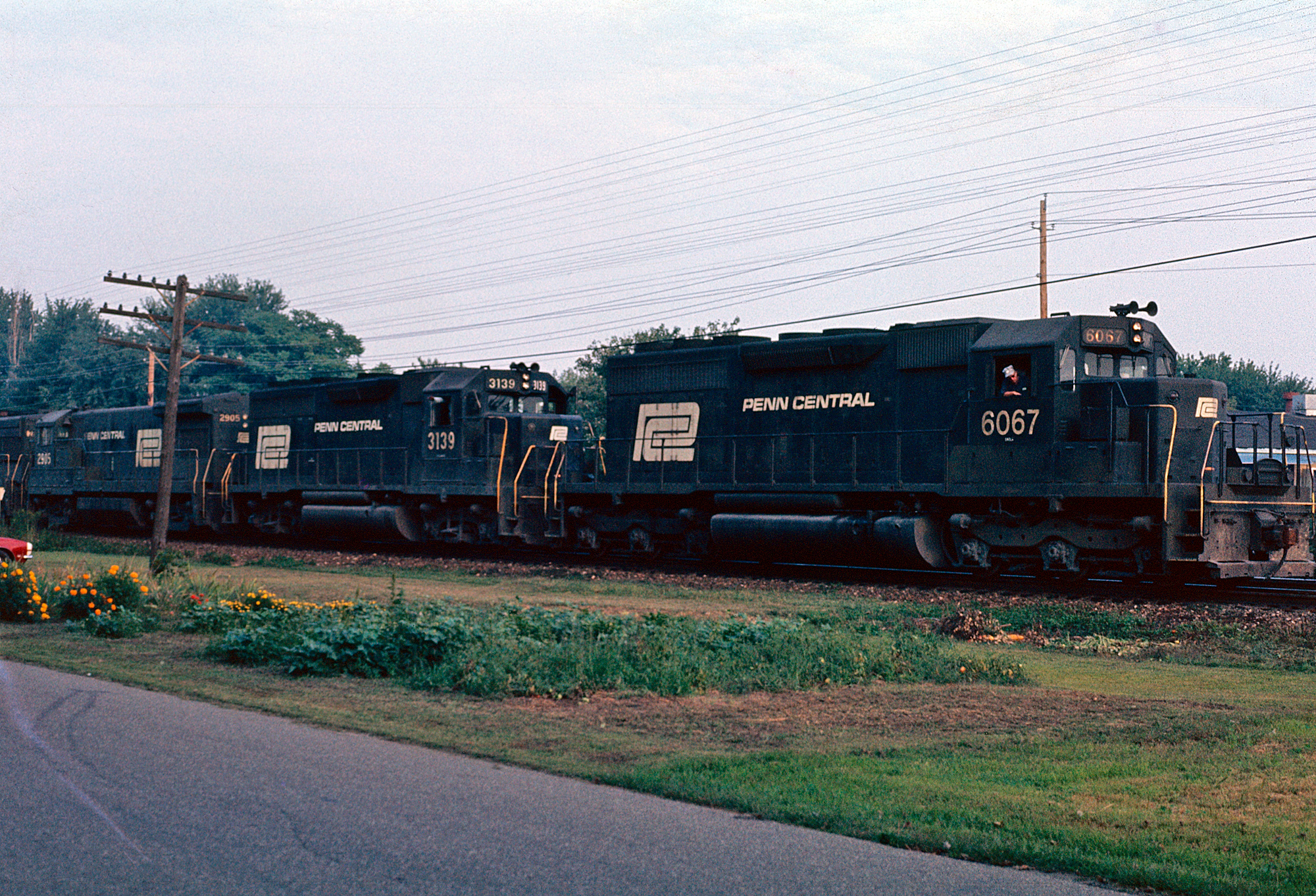
Penn Central SD40 #6067 leads a westbound freight on the Panhandle at Newcomerstown, Ohio, September 1974. American-Rails.com collection.
Passenger Trains & the Blue Ribbon Fleet
Freight paid the bills; passenger trains made the timetable famous. Many of the Pennsylvania Railroad’s premier western services used Panhandle trackage as all or part of their routes. Names associated with the corridor and PRR’s St. Louis / Cincinnati / Midwest services include the Spirit of St. Louis, Penn Texas, Cincinnati Limited, Jeffersonian, and Liberty Limited, among other Blue Ribbon Fleet and secondary trains. Period practice often combined or split sections at hubs such as Columbus as schedules evolved.
These were not branch locals. They were through trains linking New York, Philadelphia, Washington, and Pittsburgh with St. Louis, Cincinnati, and other Midwestern cities—competing with New York Central, Baltimore & Ohio, and other rivals for the passenger dollar until the post–World War II decline, the creation of Amtrak in 1971, and the later thinning of the national network. When Amtrak drew its map, it did not preserve every PRR western path; understanding which named trains once used the Panhandle helps explain both the corridor’s prestige and how much passenger geography has since been erased.
See also: PRR passenger trains · Streamliners · Amtrak.
System Maps (1893)
Period maps remain the best way to grasp how many corporate strands fed the Panhandle name. The 1893 sheets below show the PCC&StL family shortly after the great consolidation, with principal connecting lines—useful companions to the route tables above.
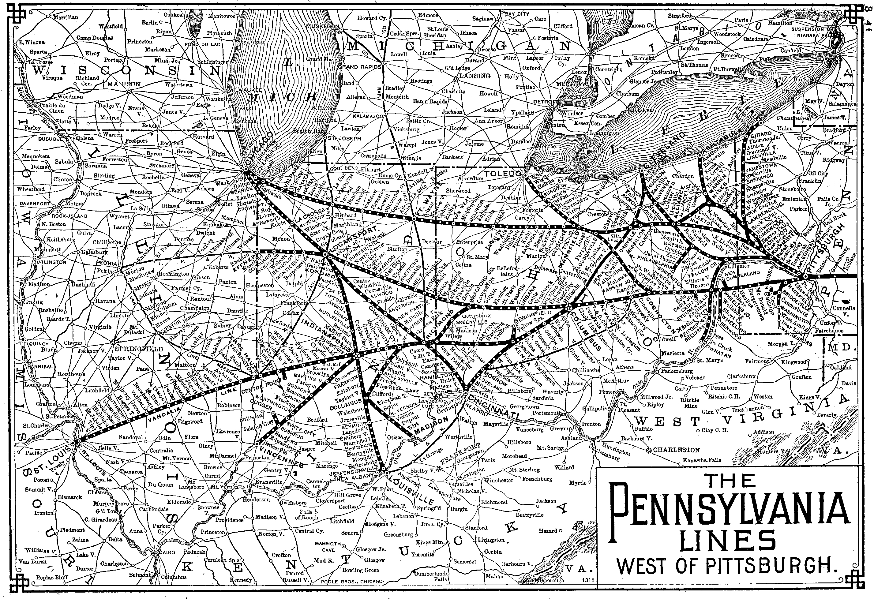
PCC&StL system map, 1893 (sheet 1). Click through for full resolution. American-Rails.com collection.
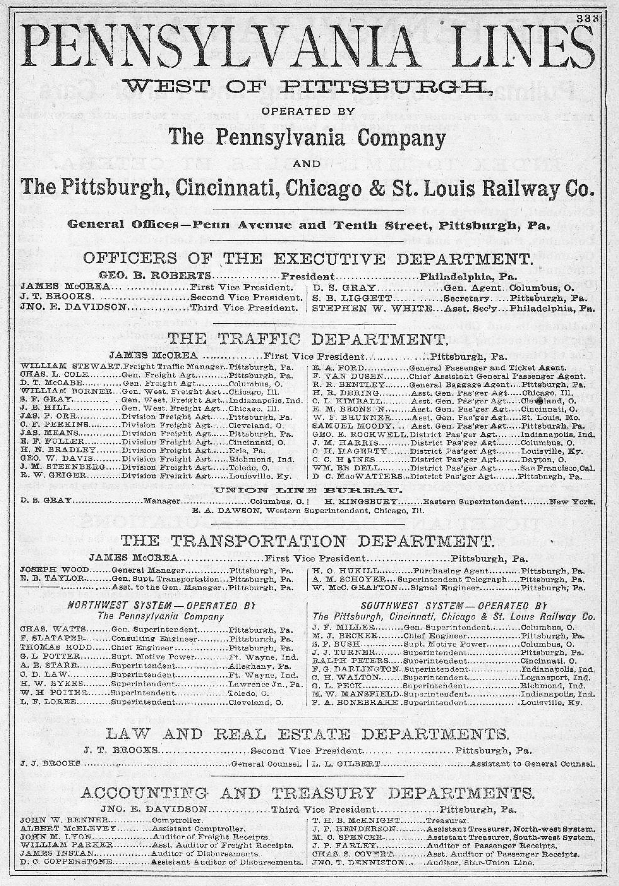
PCC&StL system map, 1893 (companion sheet). American-Rails.com collection.
Life Under the Pennsylvania Railroad
By the early 20th century the Panhandle was fully embedded in PRR operating practice: Pennsylvania Company / Lines West management layers, shared power pools, standard signal and rule culture, and investment patterns that favored the busiest mains. Post–World War II descriptions of the St. Louis / Cincinnati main and the secondary Chicago route via Columbus and Logansport still paint them as well-maintained, often double-track arteries—exactly the kind of plant the Pennsy wanted for high-density freight and remaining first-class passenger trains.
Dieselization in the 1940s–1950s replaced steam across the system, as elsewhere on the PRR. Cab units and later Geeps and SDs became the face of Panhandle freights; passenger power followed PRR’s broader fleet story. Signaling and communication upgrades continued in step with the parent company. When the PCC&StL corporate shell was finally merged away in 1956, day-to-day operations had long since been Pennsy in all but the finest stationery.
Competition never slept. To the north and west, New York Central and the Big Four network contested Midwest flows. To the south and through the mountains, B&O remained the historic rival for Ohio Valley and St. Louis business. The Panhandle was PRR’s answer on the map: own the steel, own the schedules, own the connections at Indianapolis, Columbus, and St. Louis.
Penn Central, Conrail, Rationalization & What Survives
The 1968 Penn Central merger folded the Panhandle into a larger, troubled system. Deferred maintenance, traffic shifts, and the Northeast rail crisis led to Conrail in 1976. Conrail kept what paid and shed what did not. Through the 1980s and 1990s large pieces of the old Panhandle were downgraded, sold, or abandoned. Joseph P. Schwieterman’s When the Railroad Leaves Town (Eastern United States) is a useful companion for how individual communities experienced those losses.
Examples of the breakup pattern:
- Norfolk Southern and CSX inherited major former Conrail (ex-PRR) segments after the 1999 split; substantial Panhandle-related trackage in Pennsylvania, Ohio, and Indiana continues in freight service under those Class Is (exact subdivision names and routings have evolved).
- Short lines took islands of the old map—for example, the Louisville & Indiana on the former PRR Indianapolis–Louisville main (spun out in the Conrail rationalization era, 1994), and operators such as the Ohio Central system on portions of the ex-PRR Panhandle main across central Ohio.
- Trails reused urban and suburban rights-of-way. Near Pittsburgh, the Panhandle Trail follows former railroad alignment for cyclists and pedestrians—a direct place-name survival of the old route even where rails are gone inside the city’s western approaches.
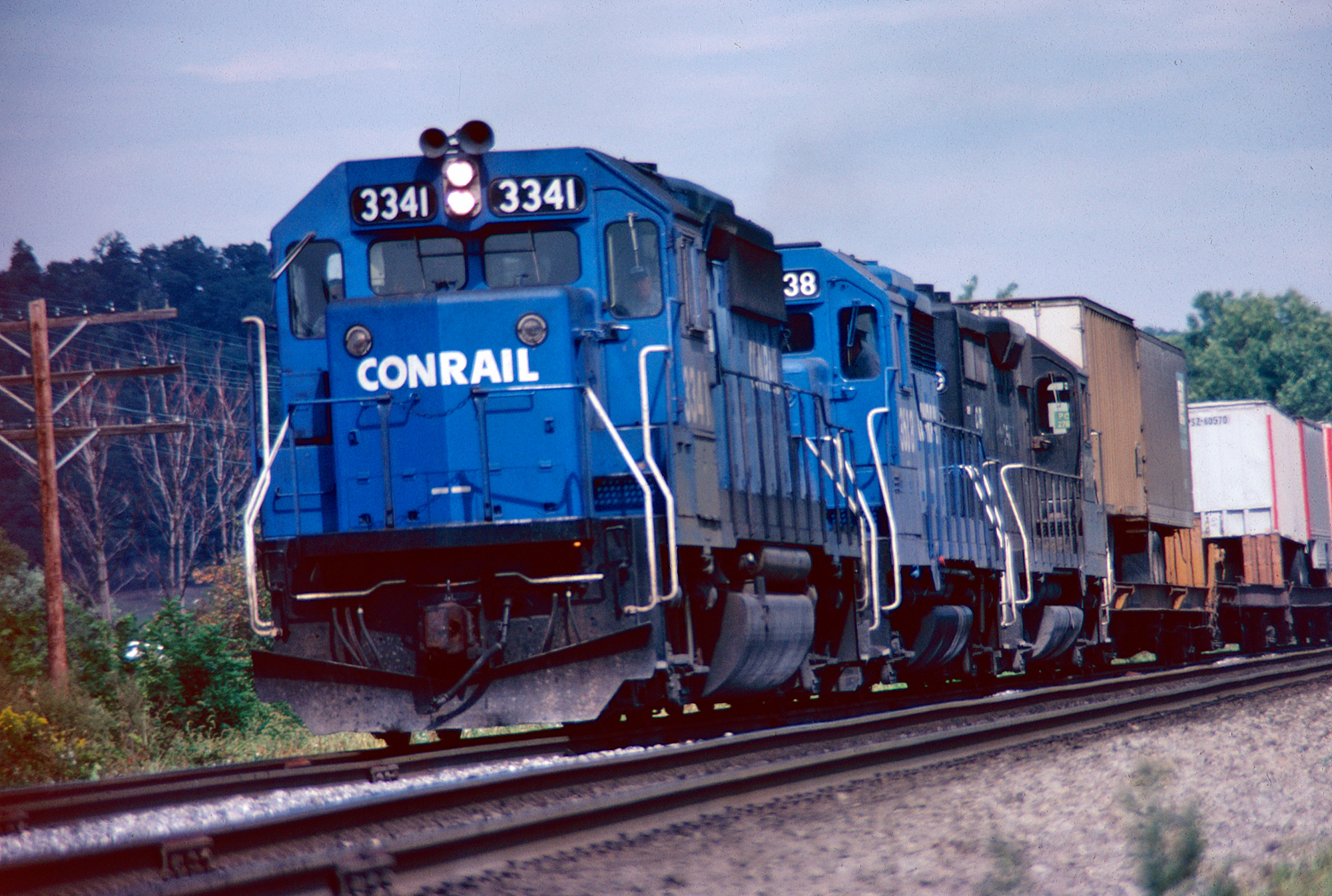
Conrail GP40-2 #3341 hustles train TV-3m along the Panhandle near Port Washington, Ohio, September 28, 1980. Roger Beighley photo. American-Rails.com collection.
So the Panhandle is a fallen flag in the corporate sense—the PCC&StL name is gone, the PRR is gone, Penn Central is gone—but it is not a vanished line in the physical sense. Manifests still roll where the plant remains useful; short lines work industrial leftovers; trails mark the rest. That mix is typical of Midwestern PRR heritage after Conrail.
Related Reading on American-Rails.com
- Pennsylvania Railroad · Fallen flags · Railroad history
- PRR passenger trains · Streamliners · Amtrak
- Ohio Central · Louisville & Indiana · Class I railroads
- State context: Ohio · Indiana · Illinois · West Virginia · Pennsylvania (tourist / state entry points)
- New York Central (rival Midwest map) · Home
Sources
- Schafer, Mike, and Brian Solomon. Pennsylvania Railroad. Osceola, WI: MBI Publishing, 1997. (P&S / S&I / Panhandle origins and PRR western strategy)
- Schafer, Mike. Classic American Railroads. Osceola, WI: MBI Publishing, 1996.
- Schwieterman, Joseph P. When the Railroad Leaves Town: Eastern United States. Kirksville, MO: Truman State University Press, 2001. (community-level abandonments and aftermath)
- Corporate and route summaries of the Pittsburgh, Cincinnati, Chicago & St. Louis Railroad / Panhandle Route (lease and 1956 merger into the PRR family; Lines West structure)
- Period system maps (1893) and employee/public timetable tradition for principal corridors and named trains
- American-Rails.com related profiles: Pennsylvania Railroad; PRR passenger services; Ohio Central; Louisville & Indiana; fallen-flags hub
Originally published on American-Rails.com and revised August 23, 2024; substantially rewritten and expanded August 13, 2026 to strengthen structure (anchors, tables, clearer Fort Wayne vs. Panhandle distinction, passenger and survival sections) while retaining the core research on Pittsburgh & Steubenville, Steubenville & Indiana, Hollidays Cove, the 1865 Ohio River crossing, 1868 Panhandle / PC&StL organization, 1890 PCC&StL consolidation, ~2,700-mile peak, Blue Ribbon passenger names, and successor operations.
Recent Articles


-
Minneapolis, Northfield and Southern Railway: Map, History, Rosters
Oct 27, 26 10:32 AM
 The Minneapolis, Northfield & Southern, the Dan Patch Line that became a Twin Cities belt. Steam, gas-electric mules, motor cars, and the 22 diesels, through the Soo Line.
-
Minneapolis & St. Louis Diesel Roster (All-Time)
Oct 27, 26 10:27 AM
 All-time diesel roster of the Minneapolis & St. Louis. 97 locomotives, each frame once. Switchers from 1938, 35 RS-1s, the FT and F-unit cabs, two SD7s, and 23 GP9s. Builder numbers included.
-
Minneapolis & St. Louis Steam Roster (Post 1900)
Oct 27, 26 10:25 AM
 Minneapolis & St. Louis steam locomotives built since 1900. Moguls, Consolidations, 35 Mikados, and five Pacifics.
-
Minneapolis and St Louis Railway: "The Peoria Gateway"
Oct 27, 26 09:52 AM
 The Minneapolis & St. Louis, the Tootin' Louie, from the 1870 charter to the Peoria Gateway and the Chicago & North Western sale on November 1, 1960.
-
Alco "PA" Locomotives: Restoration, Specs, Engine, Rosters
Oct 27, 26 12:12 AM
 Alco's PA passenger cab, 297 locomotives built from 1946 to 1953. The 244 engine, the production roster, the Delaware & Hudson PA-4s, and Nickel Plate Road 190.
-
Milwaukee Road Diesel Roster: (All Time)
Oct 26, 26 01:44 PM
 All-time diesel roster of the Milwaukee Road. 1,208 locomotives, each frame once. Alco, Baldwin, Davenport, EMD, Fairbanks-Morse, General Electric, and Whitcomb, with builder numbers.
-
Milwaukee Road Steam Roster (All-Time): Post-1900
Oct 26, 26 01:38 PM
 Milwaukee Road steam locomotives built since 1900. Prairies, Mikados, the N-class articulateds, the S-class 4-8-4s, and the Hiawatha Atlantics and Hudsons. Quantity column 1,974. Unique frames 1,951.
-
Milwaukee Road: Map, Electrification, Logo, History
Oct 26, 26 01:20 PM
 The Milwaukee Road, from the Milwaukee & Mississippi of 1850 to the Pacific Coast Extension, the Hiawathas, and the Soo Line sale. Why Lines West should have stayed.
-
Lake Superior & Ishpeming Railroad: Map, Roster, History
Oct 25, 26 11:38 PM
 Lake Superior & Ishpeming Railroad, reporting mark LSI, from the Marquette Range to the Presque Isle ore dock. The 1954 steam list and the diesels the railroad owned.
-
Kansas City Southern Steam Roster (Built Since 1900)
Oct 25, 26 09:09 PM
 Steam locomotives of the Kansas City Southern built since 1900, with the Louisiana & Arkansas and the Texas company.
-
Kansas City Southern Diesel Roster (Built New)
Oct 25, 26 11:46 AM
All-time diesel roster of the Kansas City Southern. E units, F units, Geeps, SD40s through SD70ACes, Fairbanks-Morse, Baldwin, Alco, and General Electric, with serials and order numbers. -
Kansas City Southern Railway: Map, Photos, History
Oct 25, 26 12:24 AM
 The Kansas City Southern, from Arthur Stilwell's Gulf line to Canadian Pacific Kansas City on April 14, 2023. Steam and diesel rosters, the Southern Belle, and the Louisiana & Arkansas.
-
Indiana Harbor Belt Diesel Roster (All-Time)
Oct 25, 26 12:17 AM
 All-time diesel roster of the Indiana Harbor Belt. 202 locomotive frames, each counted once. NW2s, SW7s, SW1500s, road switchers, and gensets. Slugs and boosters are outside the count.
-
Indiana Harbor Belt Steam Roster (Built Since 1900)
Oct 25, 26 12:13 AM
 Steam locomotives of the Indiana Harbor Belt built since 1900. 182 engines, each counted once. 0-6-0s, 2-6-0s, 0-8-0s, and 2-8-2s. The three U-4a switchers are three-cylinder Brooks engines of 1927.
-
Indiana Harbor Belt Railroad: Map, Rosters, History
Oct 25, 26 12:00 AM
 Indiana Harbor Belt, the inner belt across the Calumet, from the East Chicago Belt of May 16, 1896. Renamed June 29, 1907. Still operating, headquarters Hammond. Steam roster is the companion, 182 loc…
-
NYC's "P Motor" Electric Locomotives
Oct 24, 26 11:43 PM
 New York Central P motors: 22 Alco-GE 2-C+C-2 electrics, Cleveland Union Terminal 1050–1071, class P-1a. 3,030 hp one-hour on 3,000-volt DC catenary, then 660-volt third rail as P-2a and P-2b.
-
Illinois Terminal Car Roster
Oct 24, 26 11:40 PM
 Illinois Terminal cars. Mainline motors, the 1948 streamliners, sleepers, Alton and Valley Division cars, express motors, and the line cars rebuilt from pull cars.
-
Illinois Terminal Diesel Roster
Oct 24, 26 09:31 PM
 All-time Illinois Terminal diesels, 62 frames. Alco S-2s and RS-1s, EMD switchers, GP7s, SD39s, GP38-2s, and the two GP20s. Serial numbers from the 1989 roster.
-
Illinois Terminal Electric Locomotives
Oct 24, 26 08:22 PM
 Illinois Terminal electric locomotives, 57 frames. Class A through Class D, the Decatur-built motors, and the battery locomotives. Class D is the same five Class C frames, rebuilt.
-
Illinois Terminal Steam Roster
Oct 24, 26 07:37 PM
 Illinois Terminal steam locomotives, 36 frames. Baldwin Moguls, three Class 30 Mikados, Florida East Coast 0-8-0s, and 2-6-0 No. 21, the last fire on June 30, 1950.
-
Illinois Terminal Railroad: Map, Roster, Photos, History
Oct 24, 26 07:32 PM
Illinois Terminal, McKinley's Illinois Traction System, from the Danville coal towns to St. Louis. The McKinley Bridge, the sleeping cars, the 1937 break with the power company, the 1948 streamliners… -
Southern Railway Diesel Roster (All-Time)
Oct 23, 26 11:00 PM
 All-time diesel roster of the Southern Railway. 2,505 locomotives in the system number series, from the 1939 demonstrator FT to GP50s and B30-7A1s. Serials included.
-
Illinois Central Diesel Roster (All-Time)
Oct 23, 26 04:06 PM
Illinois Central and Illinois Central Gulf diesel locomotives, each frame once. The quantity column is 886. Serials and order numbers from Electro-Motive's builder lists. Paducah rebuilds and Gulf, Mo… -
Illinois Central Gulf Diesel Roster
Oct 23, 26 04:02 PM
 Illinois Central Gulf operating numbers from August 10, 1972, to February 29, 1988. New frames stay on the Illinois Central diesel roster. Gulf, Mobile and Ohio frames stay on that roster. No Gulf fle…
-
Illinois Central Railroad: Map, Logo, History
Oct 23, 26 03:50 PM
Illinois Central, the Main Line of Mid-America, from the 1850 land grant to Canadian National control on July 1, 1999. Charter lines, Cairo bridge, Paducah, and the Illinois Central Gulf. Steam quanti… -
Grand Trunk Western Diesel Roster (All-Time)
Oct 23, 26 12:53 PM
 Grand Trunk Western diesel locomotives, each frame once. The quantity column is 377. Serials are filled for the Detroit, Toledo and Ironton and Detroit and Toledo Shore Line engines the railroad kept…
-
Grand Trunk Western Steam Roster
Oct 23, 26 12:14 PM
 Grand Trunk Western steam locomotives in service about 1937 to 1942, from Richard Leonard's class list. Drury has no chapter. The quantity column is the counted Grand Trunk Western rows. Two mixed Gra…
-
Grand Trunk Western Railroad: Map, Roster, History
Oct 23, 26 12:09 PM
 Grand Trunk Western, reporting mark GTW, Canadian National's railroad between Port Huron and Chicago. Trade name adopted in 1923. Steam class list quantity 232. Diesel quantity column 377. Identity in…
-
Green Bay and Western Railroad: Map, Rosters, History
Oct 22, 26 11:18 PM
 Green Bay & Western, the Green Bay Route, reporting mark GBW. From Kewaunee to Winona. Mailer's steam and diesel rosters, and the August 1993 sale to Fox Valley & Western.
-
Chicago & North Western Class E-4: Streamlined 4-6-4 Hudsons
Oct 22, 26 10:28 PM
 C&NW Class E-4, nine streamlined 4-6-4s, 4001–4009, Alco 1938. 84-inch drivers, 25-by-29 cylinders, 300 psi. Conventional Chicago–Omaha trains. Oil in 1947–48. Retired 1953–1956.
-
Gateway Western Railway: Map, Roster, History
Oct 22, 26 02:43 PM
 Gateway Western Railway, reporting mark GWWR. Class II from Kansas City to East St. Louis. Kansas City Southern control May 5, 1997. The 1992 diesel fleet, with serials and order numbers.